
Land nobody else is looking at
Nothing Tractex searches is for sale. These are ownership records, so every result is off-market by definition and you are not bidding against everyone who set an alert on the same listing.

Describe the project the way you would to a colleague. Tractex reads the county's own ownership records live, scores every parcel against what you actually need, and hands back a ranked, mapped shortlist with the flood zones, the slopes and the septic problems already on it.
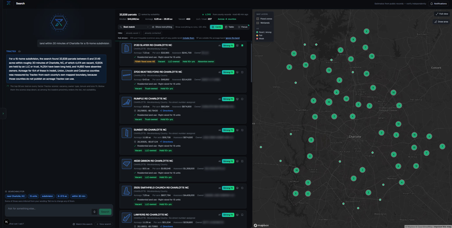
What you get
Nothing Tractex searches is for sale. These are ownership records, so every result is off-market by definition and you are not bidding against everyone who set an alert on the same listing.
Thirty fields arrive attached to every parcel, from flood zone and soil through septic suitability, zoning, wetlands and road access. The deal breakers surface in the first minute rather than the third week.
Every parcel carries the reasons it ranked where it did and the public source behind each field, so the list holds up to the first hard question from a partner, a lender or your own engineer.
Inside the workspace
Real captures from the working product, not mockups and not renders. Owner names are blurred. Nothing else is staged.
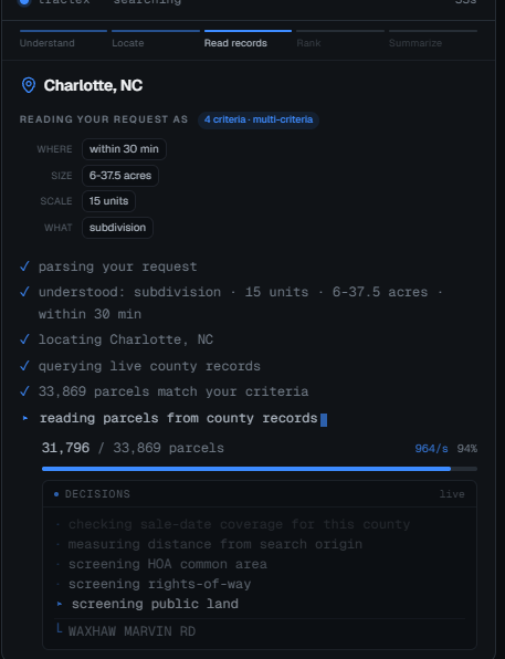
A search in progress. Tractex restates the request as structure, resolves the location, then goes to the counties and reads parcels. In this capture that is 33,869 of them at just under a thousand a second, with each decision named as it is made: checking sale-date coverage, measuring distance from the search origin, screening common area and rights of way.
None of it is served from a warehouse. That is the whole difference, and it is why a search here takes a minute rather than an instant.
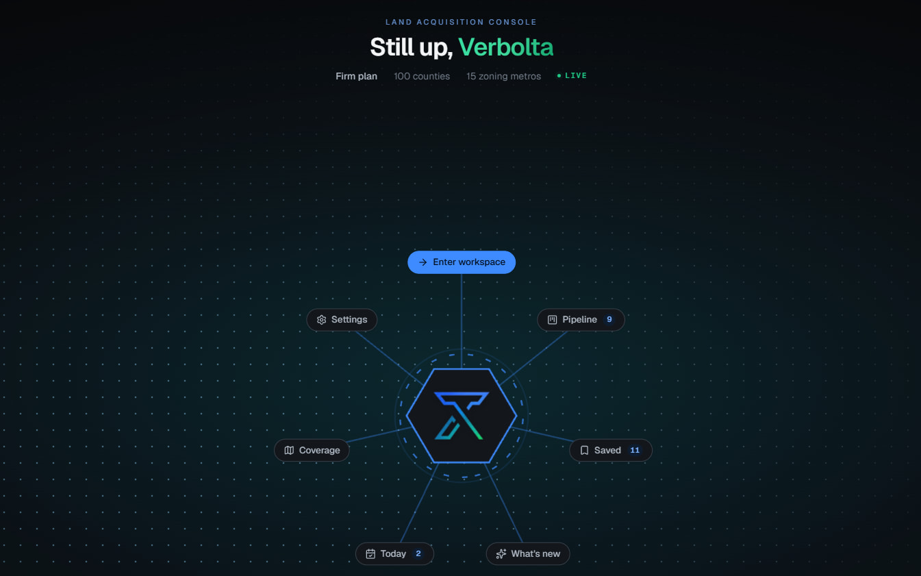
Saved parcels, live deals, county coverage and anything that moved overnight, on one screen before a search is ever run.
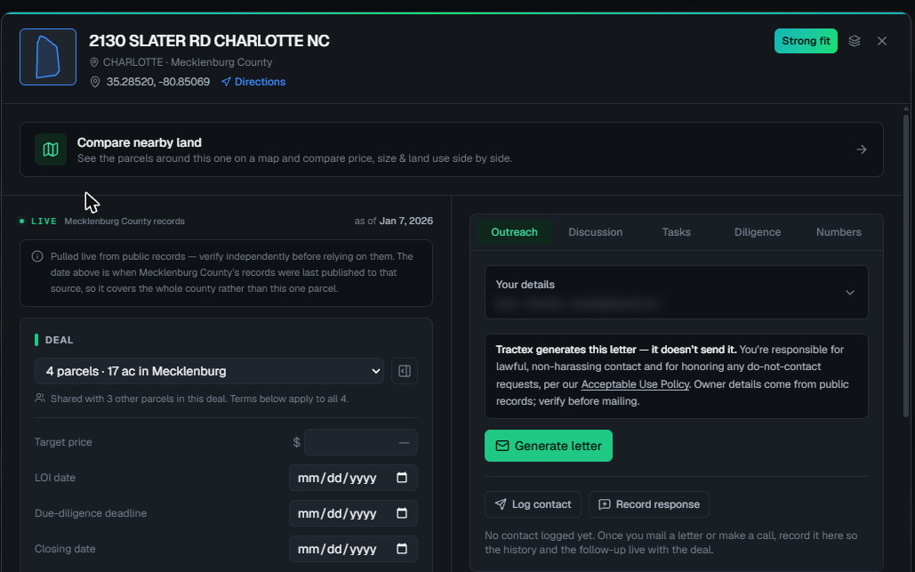
Acreage, assessed value, land use and ownership on the left; target price, LOI date and closing date on the right. The county record and your deal terms stop living in separate files.
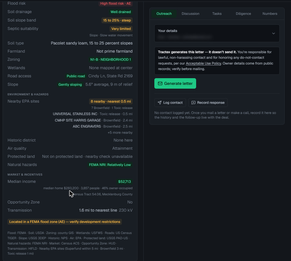
Thirty fields on every parcel: flood, soil, slope, septic, zoning, wetlands, road access, last sale, structures, nearby EPA sites, protected land, census income, transmission distance. Each one carries the public source it came from.
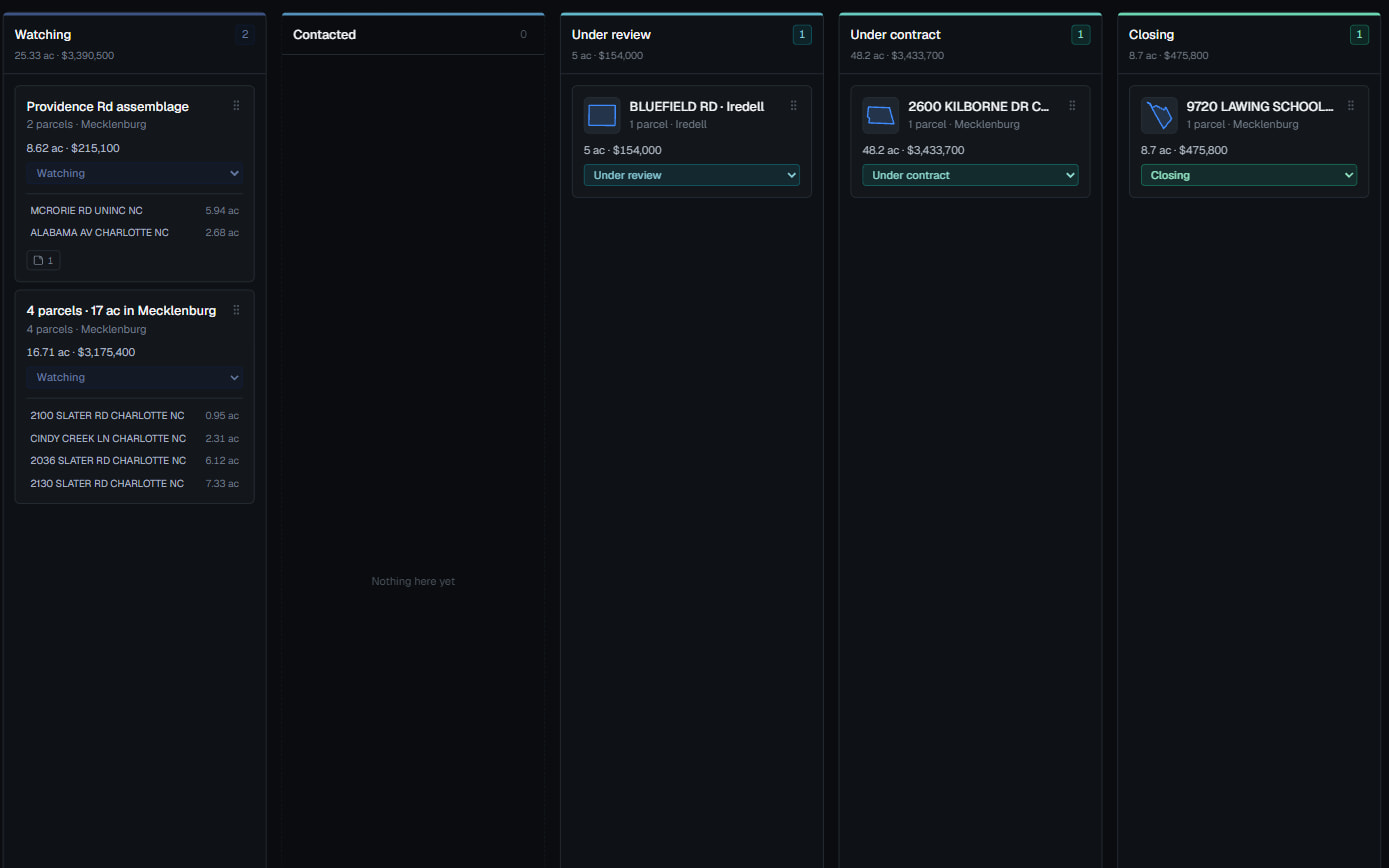
Watching, contacted, under review, under contract, closing. Parcels assemble into deals and deals carry acreage and money, so the board is the pipeline rather than a picture of one.
Tractex looks at what you have already saved and tells you what it sees. Two of these parcels turn out to share one owner, which is 7.1 acres under a single negotiation rather than two. Ten of the eleven sit in one county, so a watched search there will surface new land the moment it is recorded. One has been sitting untouched for a fortnight.
The panel says of itself that every line is a fact from your data, never a guess, and that it costs nothing to run. That is the same rule the rest of the product follows, turned on the workspace instead of the county.
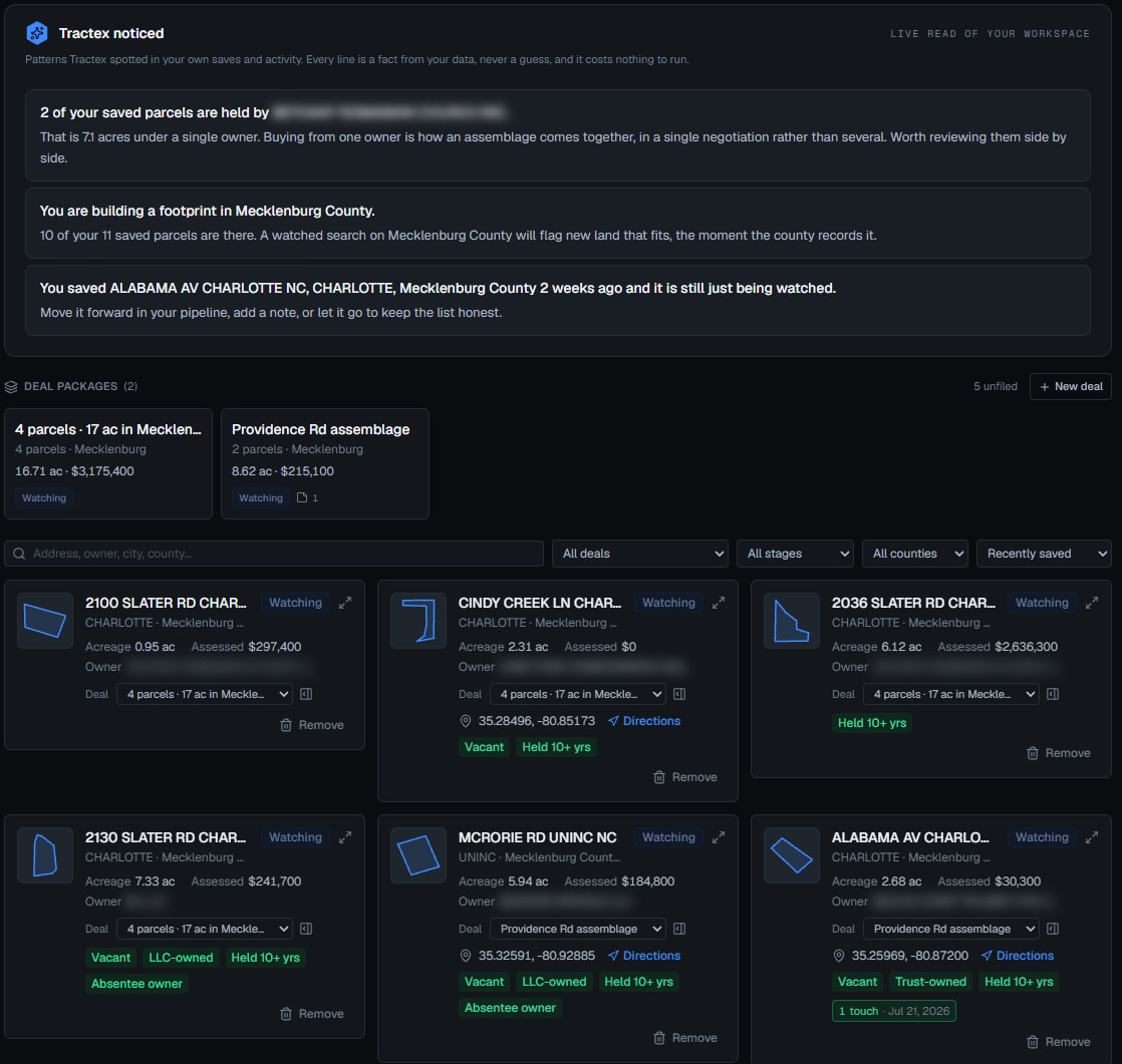
Captured 6 August 2026 from the working build, against live North Carolina county records. Owner names and mailing addresses are blurred. Figures belong to that one capture and will differ from any given search.
Feasibility
Finding the parcel is half the job. Tractex runs the residual method on your own assumptions and shows every step, so the answer is yours to check rather than a number to take on faith.
Usable share, lots per acre, revenue per lot, site cost, soft costs, contingency, finance and carry, and the profit you require. Tractex brings the parcel and the acreage. Every figure that decides the answer is one you entered yourself.
Gross revenue, site development, soft costs, contingency, finance and carry and required profit each appear with the arithmetic that produced them, down to the residual land value at the bottom. Nothing happens off-screen.
When the costs and your required profit consume the revenue, it says the assumptions leave nothing for the land and prints the figure in red. A tool that only ever encourages you is not doing arithmetic.

Most software in this category will happily hand you a valuation. Tractex refuses, in writing, on the same screen where it does the maths. It will not estimate land value and it will not score your deal, because both would be a guess wearing a number's clothing.
How it works
Describe the project the way you would to a colleague. There is no query builder to learn and no saved-search syntax to remember.
Comparable tools copy county data into a warehouse and serve results from that copy. Tractex queries the county during the search, so what you see is current at the moment you ask.
Scoring uses a fixed set of published rules with no AI anywhere in it. The same parcel and the same request always produce the same result, and every point traces back to a rule you can read.
Public records are uneven. Most systems collapse "not recorded" into "no". Tractex keeps them apart and says which it is, because a confident wrong answer is worse than an honest gap.

The best result on the list is also in a flood zone, and both facts sit on the same row. The score is not quietly discounted and the flag is not buried a click away.

Not on protected land, and the nearby check was unavailable. Two different statements, kept apart, rather than rounded together into a clean and slightly false no.

Every parcel closes with the source behind each field. FEMA, USDA, county GIS, USFWS, USGS, NPS, EPA, Census, HUD. A number you cannot trace is a number you should not trust.
How it started
Tractex began as Zack's idea, and he still shapes where the product goes.
Client work taught us the parts that actually matter: data modelling, deployment, and being honest about what a system does not know. We started building for ourselves.
The search pipeline, the scoring model and the data layer underneath are all our own work. In private development for the North Carolina market, with the engine and workspace complete and hardening ahead of launch.